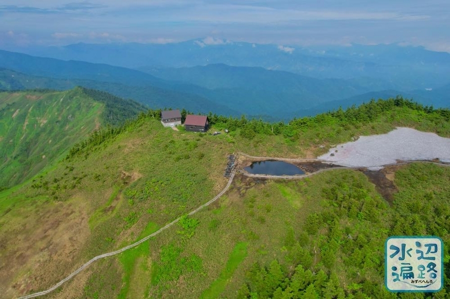
百名山・会津駒ヶ岳山頂と連なる稜線上にある山池
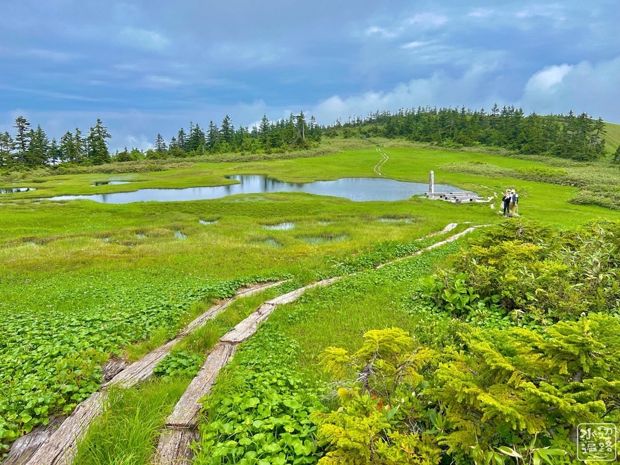
中門岳(2,060m)の山頂近くの稜線上にある湿原内の池。湖面標高2,045m程度。会津駒ヶ岳では最大の山池。

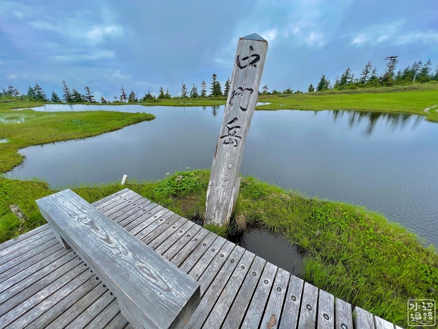
「中門大池」の池名
池名は地理院地図やGoogleマップ上での記載はなく、現地に立つ標柱も「中門岳」と記されているが「中門大池」の文字はない。この名が記載されているのは、滝沢登山口へのアクセス路入口公衆トイレ前に掲げられた「尾瀬国立公園マップ」。


中門大池の景観・形態
中門大池のウッドデッキ


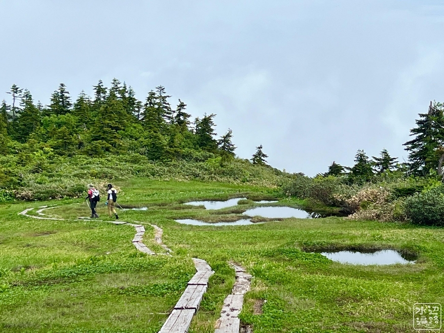
周辺の池塘
稜線上には多くの田代と池塘がある。


見かけた動植物
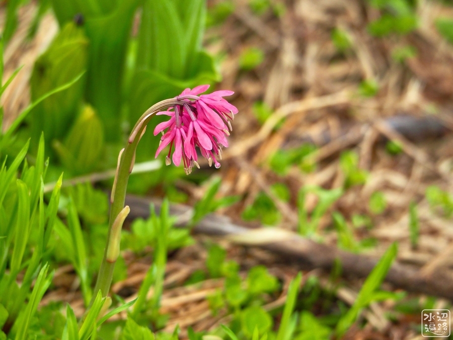
ショウジョウバカマ
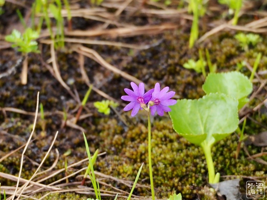
ハクサンコザクラ
その他


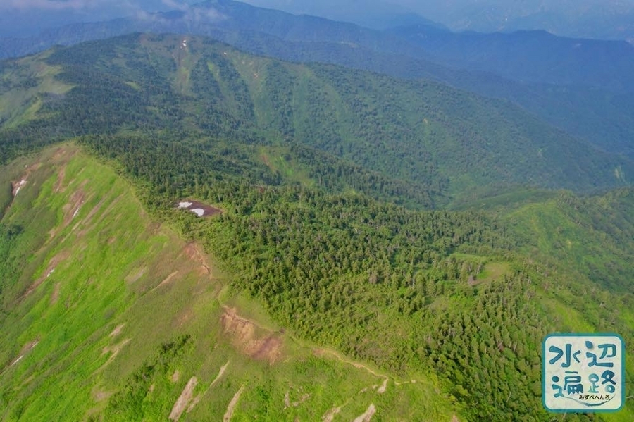
中門大池と周辺地形(空撮)
中門大池
雪代にまじっていくつもの池塘があり、奥に中門大池、そして中門岳の頂上湿原が見える。


駒ノ大池と中門大池の間の稜線池塘群


駒ノ大池の南西稜線の池塘
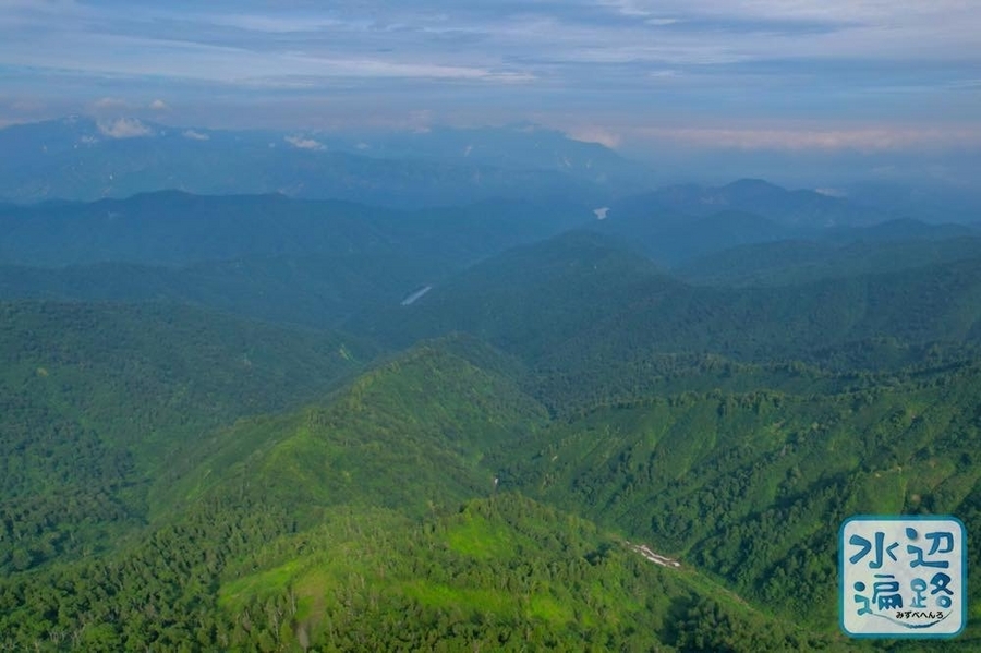
大津岐ダムと奥只見湖
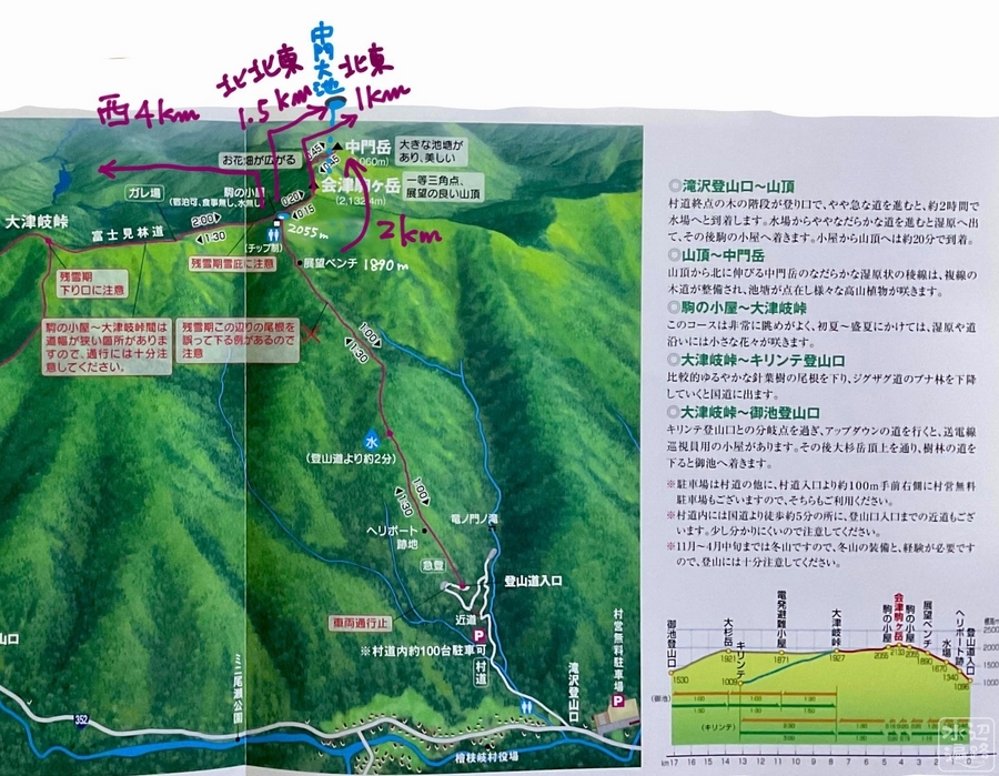
中門大池へのアクセス
駒ノ大池〜中門大池(恐怖! すべりすぎる木道)
駒ノ大池から駒ヶ岳山頂経由の稜線歩きで往復1.5時間。
7月でも残雪あり。


マップ
現地の案内マップ


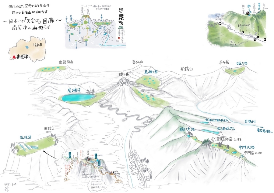
南会津の池さんぽマップ
2023年7月に、会津駒ヶ岳、尾瀬、弘法沼の3枚の池さんぽマップを統合し「南会津池さんぽマップ」ver.1.0を作成。