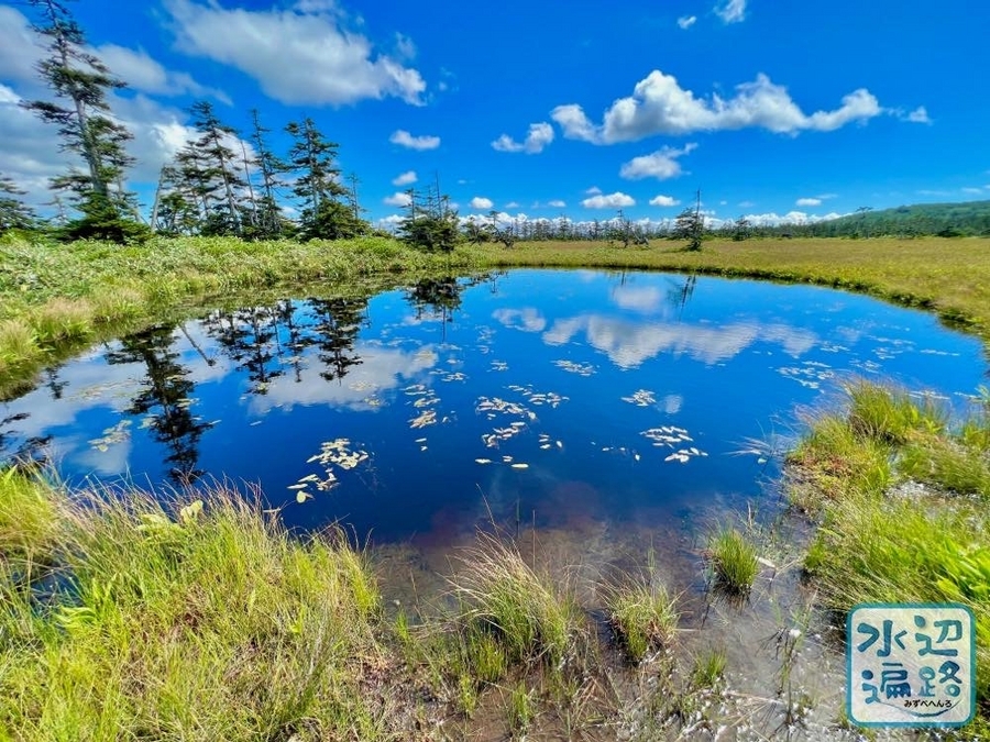
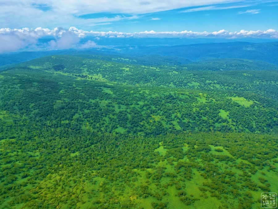
日本最北の高層湿原の沼
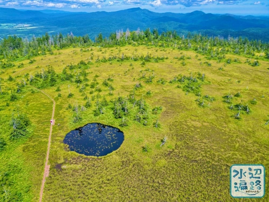
北見山地ピヤシリ山系の海抜高797mのテーブルマウンテンの頂上台地に広がる松山湿原には、名の付いた三つの沼がある。
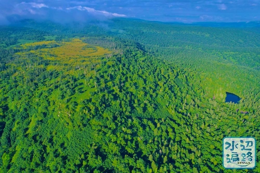
ほか南にあるピヤシリ山へと続くテーブル台地にある名の分からぬ沼沢群の姿も空撮で捉えることができたので併せて掲載。
日本最北の高層湿原でもある松山湿原は日本の重要湿地500にも選定。
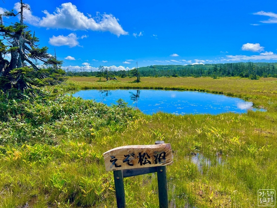
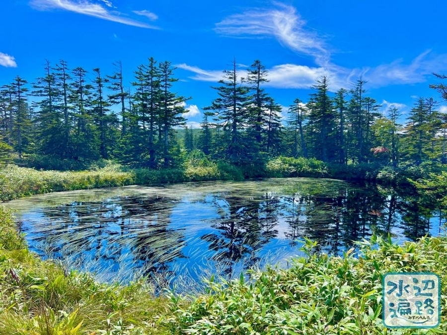
えぞ松沼
円形の沼沢。底が見えないほどの水深はあった。
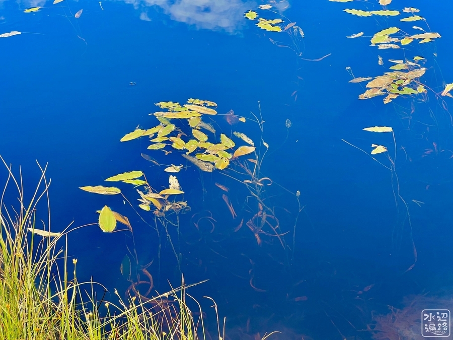


つつじ沼
ウキミクリ群落が黒い水にみごとな文様をつくっていた。


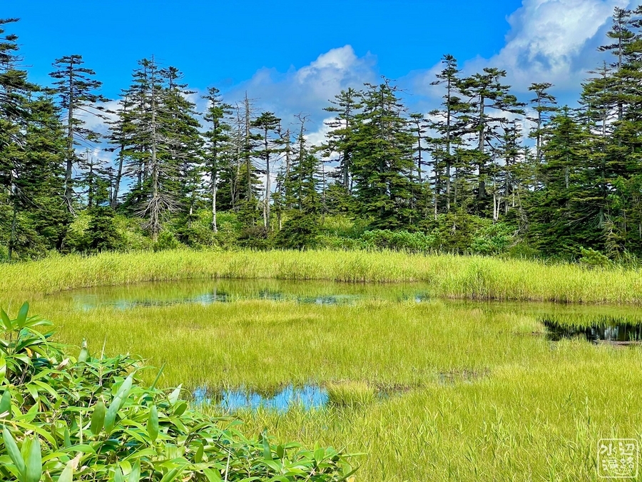
はい松沼
抽水植物が繁茂し水面が少なくなっていた。なんとなくだけど、はい松沼とえぞ松沼のネーミングが逆のようなしっくりくる気がした。


松山湿原の地形(空撮)
遠景
天竜沼と。


えぞ松沼、はい松沼、つつじ沼


ピヤシリ山の沼沢群


足寄方面
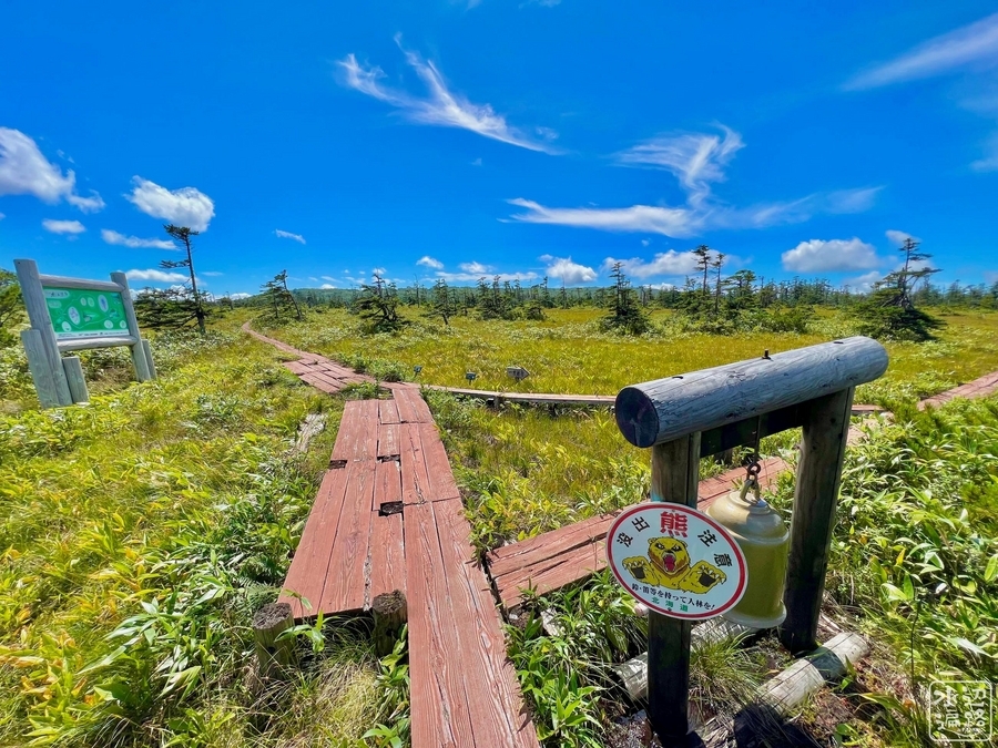
アクセス
天竜沼(登山口駐車場)
天竜沼の駐車場まで舗装林道が通じている。トイレあり。


登山口
駐車場から歩いてすぐ。


眺望所


湿原入口
案内マップの沼の絵が素晴らしすぎる。


Googleマップ
トイレマークは登山口近くのトイレ付きの駐車場。茶色のマークは、はい松沼。