資料館が付随した黒塚古墳の堀割。古代の古墳であるが戦国時代は砦に転用された。
釣り禁止。駐車場あり。
以下、現地の案内板より。
くびれ部付近で検出された掘割である。V字状にうがたれ、上面の幅ば約6mあり、深さは3mに達する。後円部と前方部を分断して、後円部を主郭とし守りの要としたのであろう。室町時代後半の戦国時代になると古墳が大幅に改変されて砦として利用されたのである。
![](https://cdn-ak.f.st-hatena.com/images/fotolife/c/cippillo/20240501/20240501175554.jpg)
![](https://cdn-ak.f.st-hatena.com/images/fotolife/c/cippillo/20240501/20240501175535.jpg)
![](https://cdn-ak.f.st-hatena.com/images/fotolife/c/cippillo/20240501/20240501175605.jpg)
![](https://cdn-ak.f.st-hatena.com/images/fotolife/c/cippillo/20240501/20240501175526.jpg)
![](https://cdn-ak.f.st-hatena.com/images/fotolife/c/cippillo/20240501/20240501175550.jpg)
![](https://cdn-ak.f.st-hatena.com/images/fotolife/c/cippillo/20240501/20240501175541.jpg)
![](https://cdn-ak.f.st-hatena.com/images/fotolife/c/cippillo/20240501/20240501175546.jpg)
![](https://cdn-ak.f.st-hatena.com/images/fotolife/c/cippillo/20240501/20240501175600.jpg)
日本最古の歴史さんぽコース「山の辺の道」の途中にある
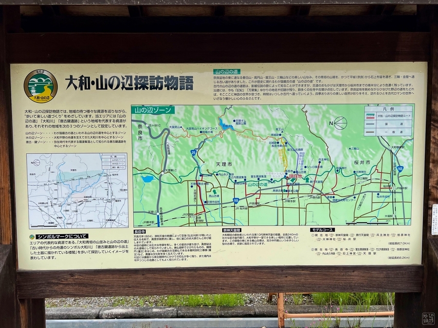
駐車場・資料館・案内板
![](https://cdn-ak.f.st-hatena.com/images/fotolife/c/cippillo/20240501/20240501175703.jpg)
![](https://cdn-ak.f.st-hatena.com/images/fotolife/c/cippillo/20240501/20240501175522.jpg)
![](https://cdn-ak.f.st-hatena.com/images/fotolife/c/cippillo/20240501/20240501175655.jpg)
![](https://cdn-ak.f.st-hatena.com/images/fotolife/c/cippillo/20240501/20240501175634.jpg)
![](https://cdn-ak.f.st-hatena.com/images/fotolife/c/cippillo/20240501/20240501175624.jpg)
![](https://cdn-ak.f.st-hatena.com/images/fotolife/c/cippillo/20240501/20240501175617.jpg)
![](https://cdn-ak.f.st-hatena.com/images/fotolife/c/cippillo/20240501/20240501175611.jpg)
Googleマップ
マークした場所は駐車場。